Hiking in Türkiye which trail or region is right for you
Long coastal paths, alpine ranges, volcanic valleys and walks of a single day, compared by season, difficulty and how you would spend the nights.
Show Me TürkiyeOctober 20268 min read
Field notes
Before you choose: what we tell friends.
01Match the season to the altitude. The coast is for February to May and September to November. The high ranges are for roughly July to September. Getting this wrong ruins more trips than fitness does.
02Waymarks vary. Even the best-known long-distance trails have sections where the paint has faded, or where a road or landslide has cut the path. Carry an offline map and the maintainer's GPX.
03The high mountains are true alpine terrain. In the Kaçkar, the Aladağlar and Cilo, weather can change within an hour, and some routes cross snow well into summer. Go with a local guide unless you have alpine experience.
04Some summits and regions need permission. Mount Ağrı (Ararat) needs an official permit arranged in advance, and parts of Hakkari have their own access rules. Check the current position before you plan around either.
05Water is the limiting factor in the south. On the Mediterranean trails, plan each day around where you can refill.
There isn't one best hike in Türkiye, so this guide helps you choose by three things: season, how hard you want it, and where you want to sleep. The first split is coast or mountain. The Mediterranean and Aegean trails are spring and autumn walking with a village bed most nights; the alpine ranges are a short summer window with real mountain risk.
For a multi-day coastal walk with guesthouses, choose the Lycian Way in spring or autumn. For high alpine scenery in summer, choose the Kaçkar Mountains or the Aladağlar, and accept that anything beyond the valleys needs experience or a guide. For easy day walks with no gear, Cappadocia's valleys and Ihlara are the most straightforward hiking in the country.
§
01
01How the main options compare
How the main options compare.
1 min read
Option
Terrain · length
Effort
Season
Logistics
Lycian Way
Coast · multi-day or sections
Moderate–hard
Feb–May, Sep–Nov
Easy: pensions, dolmuş
Carian Trail
Coast, hills · multi-day
Moderate–hard
Spring, autumn
Medium: some camping
St Paul Trail
Mountains, lakes · multi-day
Hard, remote
Spring, autumn
Complex: self-sufficient
Cappadocia, Ihlara
Valleys · day
Easy
Spring, autumn
Easy: hotel base
Kaz Dağları
Forest · day
Easy–moderate
Spring–autumn
Easy: car helps
Kaçkar
Alpine · day or multi-day
Moderate–hard
Jul–Sep
Medium; guide for crossings
Aladağlar
Alpine · base camp
Hard above valley
Summer–early autumn
Medium; guide advised
Erciyes
Volcano · summit day
Hard
Summer
Medium: Kayseri base
Ağrı (Ararat)
Glaciated summit · expedition
Very hard
Summer only
Complex: permit, agency
Cilo, Hakkari
Remote alpine · multi-day
Very hard
High summer
Complex: guide, permits
Coast in spring and autumn, mountains in summer: almost every good hiking trip in Türkiye starts from that one rule.
Use the table as a first filter, then read the chapter for your shortlist.
§
02
02Best multi-day walk
Best multi-day walk: the Lycian Way.
1 min read
The Lycian Way is the main reason many hikers come to Türkiye, and it deserves it: Lycian tombs, ruined cities and shepherds' paths high above the coast. You can take a week on one region rather than walking all of it. Different lengths are quoted for it because maintainers count newer branches and alternatives. Our Lycian Way guide sets out the stages, the route map, water, waymarking and the short sections that work best if you only have a few days.
Location: The Teke peninsula between Fethiye and Antalya.
Best for: A first long-distance trail with history, sea views and a bed most nights.
Best season: February to May, and September to November. Summer is too hot on exposed limestone.
Difficulty: Not technical, but stony, with steep climbs and descents of several hundred metres.
Nights: Village pensions and small guesthouses on most stages, with camping in places.
If you want the same coast with shorter walks, Kemer is a good base for Olympos, Phaselis and the slopes of Mount Tahtalı.
§
03
03Other long-distance trails
Other long-distance trails: St Paul and the Carian Trail.
1 min read
The Culture Routes Society, the non-profit that maintains the Lycian Way, also looks after a wider network of long-distance routes. Two of them suit hikers who have already walked the Lycian Way or want quieter paths.
Choose the Carian Trail if you want the Aegean in spring or autumn without the Lycian crowds. It is a waymarked route of about 800 km across Muğla and Aydın provinces, walked in sections rather than as one trip, mixing coast, olive country and ancient Carian sites around the Gulf of Gökova and the peninsulas of the south-west Aegean. Beds are not available on every stage, so some sections need camping or longer days.
Choose the St Paul Trail if you are comfortable with self-sufficiency and route-finding. It climbs north from the Perge and Aspendos area, through the Taurus Mountains towards Yalvaç and the Eğirdir lake district, with longer stretches between villages and higher ground than the Lycian Way.
For both trails, treat the maintainer's current route updates and GPX as the authority: closures, fire damage, forestry work and reroutes can affect sections, and waymarking varies from year to year. The Evliya Çelebi Way in the Bursa–Kütahya region was conceived as a riding route first; check which sections are practical on foot before you commit.
Demirkazık in the Aladağlar: limestone, scree and serious ground.
04
04Best for high mountains
Best for high mountains: the Kaçkar and the Aladağlar.
1 min read
These are Türkiye's two great alpine hiking ranges, and they feel very different. Both are serious mountains once you leave the valleys and plateaus.
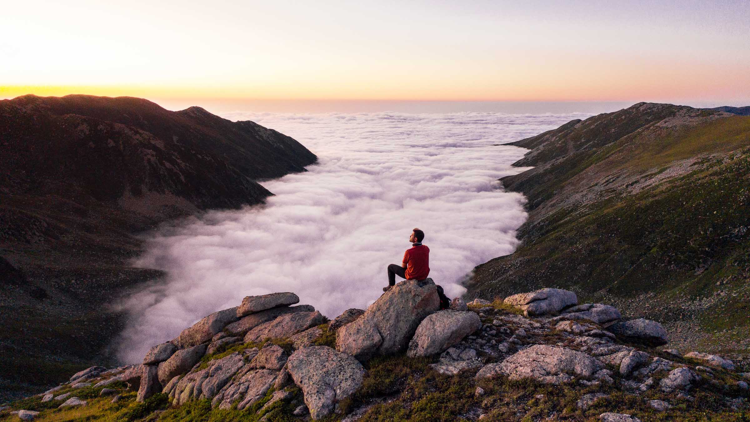
Above the cloud in the Kaçkar: the high plateaus are a July-to-September world.
The Kaçkar Mountains rise above the eastern Black Sea, with glacial lakes, high summer pastures (yayla) and a wet, green northern side. Ayder and the Fırtına Valley are the usual approach from the Rize side. Day walks between the plateaus are easy to arrange, while crossings over the main ridge are serious multi-day treks. Cloud and fog roll up from the sea, often by early afternoon, so start early. Our Rize guide covers Ayder, Elevit and the plateaus, and the Rize city guide covers where to base yourself. The Artvin side, with Şavşat and the Macahel valley, is in our Artvin guide.
The Aladağlar in the Central Taurus are drier, rockier and steeper. Limestone walls around Demirkazık rise above the Emli Valley, and most visitors base themselves in Çukurbağ or camp in the valley. Walks within the valley are accessible, but anything higher is steep scree and rock where a guide is the sensible choice. Read our Aladağlar guide for Emli, camping and the routes from the valley.
Choose the Kaçkar for lakes, meadows, village culture and a greener, wetter landscape. Choose the Aladağlar for drier weather, dramatic rock and a base-camp style trip.
Our film from the Aladağlar and the Bolkar Mountains.
§
05
05Best day hikes with no gear
Best day hikes with no gear: Cappadocia and Ihlara.
1 min read
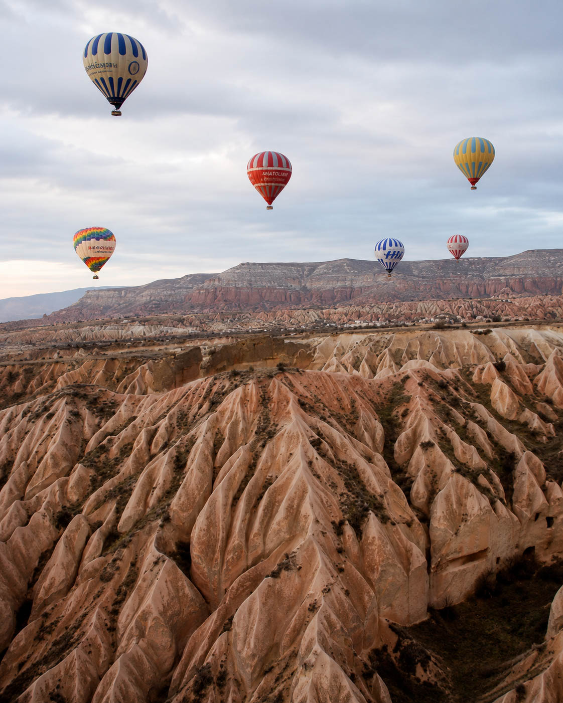
Cappadocia offers some of the most accessible serious walking in Türkiye. The Rose, Red, Love and Pigeon valleys link villages within a few hours, and you sleep in a hotel. Ihlara is a gorge walk along a river past rock-cut churches. Paths in the side valleys are informal and can split, so an offline map helps. See our Cappadocia city guide for the valleys and our Cappadocia story for Ihlara.
The Rose and Red valleys: Cappadocia’s best walking needs no gear.
Location: Göreme, Uçhisar and Ortahisar; Ihlara to the south-west near Aksaray.
Best for: First-time visitors, families, photographers and anyone short of time.
Best season: Spring and autumn. In summer, walk in the early morning.
Difficulty: Easy. Mostly valley floors and soft tuff paths, with a few short scrambles.
§
06
06Best near the Aegean
Best near the Aegean: Kaz Dağları (Mount Ida).
1 min read
Mount Ida rises above the Gulf of Edremit, with pine and fir forest, streams and village paths. Kaz Dağları is the forested, moderate choice for spring to autumn, and it pairs with a stay in Ayvalık or Assos rather than a dedicated trekking trip. Our Balıkesir guide covers the Kaz Dağları area and the national park.
§
07
07Best short coastal walk
Best short coastal walk, with a caveat: Butterfly Valley.
1 min read
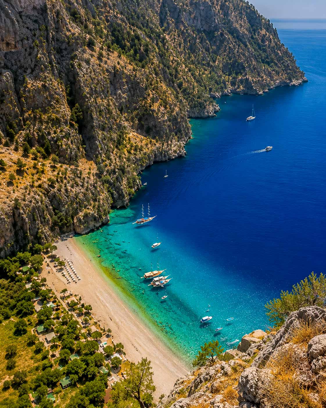
Butterfly Valley, below Faralya near Ölüdeniz, is a steep-sided cove that most people reach by boat. A path drops into it from the cliff above. That path is very steep and exposed in places, accidents have occurred on it, and access may be restricted at times, so check its current status locally before you set out. Treat it as a scramble rather than a walk, and don't attempt it in heat, wet or without good footwear. The boat is the sensible choice for most visitors. Faralya is also on the Lycian Way, so you can see the valley from above as part of that walk. See the Muğla guide.
Butterfly Valley from the clifftop. Most people arrive by boat.
§
08
08Summer summits
Summer summits: Erciyes and Ağrı (Ararat).
1 min read
Mount Erciyes, the volcano above Kayseri, is a ski mountain in winter and a summit walk in summer. The upper slopes are loose volcanic ground at altitude. It is not a casual stroll, but it is far more accessible than Ararat. See the Kayseri city guide.
Mount Ağrı (Ararat) is Türkiye's highest mountain and an expedition, not a hike. Climbing it requires an official permit, normally arranged through a licensed agency well in advance, and only on approved routes. Altitude sickness is a real risk, and the summit is glaciated. The procedure has changed over the years, so confirm the current rules with an authorised operator before you make any plans.
§
09
09Remote and serious
Remote and serious: Cilo and the Hakkari mountains.
1 min read
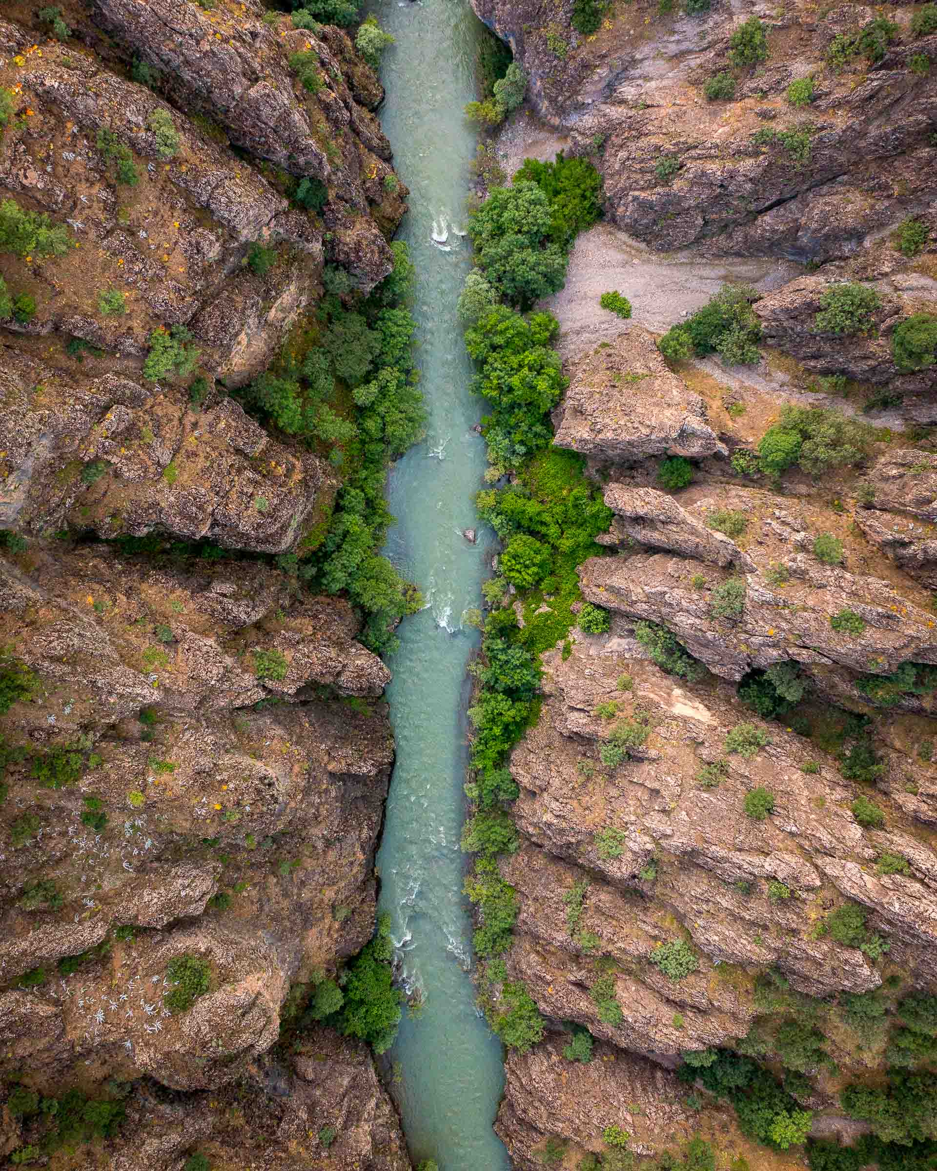
The Cilo range in Hakkari holds some of Türkiye's last glaciers and its wildest high country. It is also the most demanding place in this guide: severe terrain, weather that changes without warning, and long distances from help. Local guides are essential, and access is subject to security protocols, checkpoints and permit requirements that can change at short notice. Our Hakkari city guide explains the permit position for foreign visitors; confirm it with the Hakkari Governorate before you travel. Read the Hakkari story for the landscape and the practicalities. This is not a first trek in Türkiye.
The Zap valley in Hakkari, gateway to the Cilo range.
Our film from Hakkari and the mountains around it.
§
10
10How to choose by season
How to choose by season.
1 min read
February to May: Lycian Way, Carian Trail, lower St Paul Trail, Cappadocia, Kaz Dağları.
June: coast in the mornings only. Lower mountain valleys. The high ranges may still have snow.
July to August: Kaçkar, Aladağlar, Erciyes, Ararat (permit), Cilo (guide, permits). Avoid the hot coast.
September to November: the best all-round window, with the coast back in season and the high ranges usable into September.
Winter: low coastal sections on clear days only. The mountains are snow country.
We use essential and analytics cookies to keep this site running and understand how it is used. Analytics runs with IP anonymisation. With your consent, we may also use marketing cookies in the future. Read more in our Cookies Policy.
Cookie preferences
Choose which cookies you allow. Essential and analytics cookies are always on (legitimate interest, IP anonymisation). Your choice is saved on your device and you can change it anytime from the Cookies Policy page.
Essential
Required for core features such as remembering your language and that you have seen this notice. Always active.
Analytics
Google Analytics with IP anonymisation, used to understand how the site is used in aggregate. Always active under legitimate interest.
Marketing
Reserved for future use (e.g. retargeting). Off until you allow it.